Innowise Group
IT Outsourcing & Staff Augmentation since 2007
7901 4th St N STE 300, St. Petersburg, Florida 33702, United Stateshttps://innowise.com
Innowise Group Overview
- Number of Employees
- 1000 & Up
- Minimal Budget
- $25,000 - $50,000
- Average Hourly Rate
- $150/hr
- Year Founded
- 2007
Our expertise lies in developing tailored tech solutions that streamline processes and enhance customer satisfaction. We take pride in delivering custom software that aligns with your unique requirements, timeline, and budget. At Innowise, we offer end-to-end software development services, covering everything from conceptualization to testing, deployment, and support.
Our capabilities extend to UX/UI design, IT strategy consulting, and staff augmentation, ensuring comprehensive solutions for your technology needs. Partnering with Innowise means gaining access to dedicated professionals who are committed to your success. With our vast industry knowledge, we deliver solutions that drive growth and innovation. Contact us today to explore how our custom software development services can propel your business in Warsaw, Poland, and beyond.
More Agencies Like Innowise Group
i
Discover agencies with comparable services and expertise.
Sponsored i Placements in this section may include sponsors.
DevIT
You Dream IT - We Dev IT
- $40/hr
- Toronto, Canada
Top Services
- eCommerce Development
- Web Development
- Software Development
Roonyx
All-in-One BNPL Solution
- $150/hr
- St. Petersburg, Florida
Top Services
- Mobile App Development
- Software Development
Timspark
Software Development and Consulting Company
- $40/hr
- London, United Kingdom
Top Services
- Staff Augmentation
- Software Development
- Mobile App Development
Innowise Group Services
AI Expertise
- Chatbot Solution
- Computer Vision
- Machine Learning
- Robotics Process Automation
Big Data Expertise
- Data Migration
Blockchain Expertise
- DeFi
- Ethereum
- Hyperledger
- IBM Blockchain
- ICO Consulting
- Smart Contracts
CMS Platforms
- Drupal
- WordPress
Custom Frameworks
- .Net
- Angular Development
- Laravel
- Node.js
- React.JS
- Ruby on Rails
Custom Languages
- C
- C++
- Golang
- Java
ERP Expertise
- Microsoft dynamics 365
- SAP Business One
- SAP Consulting
Low Code Development Expertise
- Bubble
- Webflow
Mobile App Expertise
- Android
- Application Modernization
- Cross-Platform
- iPhone
Mobile App Technology
- Flutter Development
- HTML5
- React Native
Site Builders
- Godaddy
- Squarespace
Software Development Expertise
- VR/AR Education
UI/UX Expertise
- Dashboard Design
- Interactive Design
- UX Strategy
Web Design Expertise
- B2B
- Responsive
- eCommerce
eCommerce Expertise
- BigCommerce
- Salesforce
- WooCommerce
- eCommerce Consulting
Industries
- Education
- Retail
- Hospitality
- Software & IT Services
- Finance
- Fintech
Client Types
- Small Businesses
- Medium Businesses
- Enterprise / Corporate
Innowise Group Portfolio
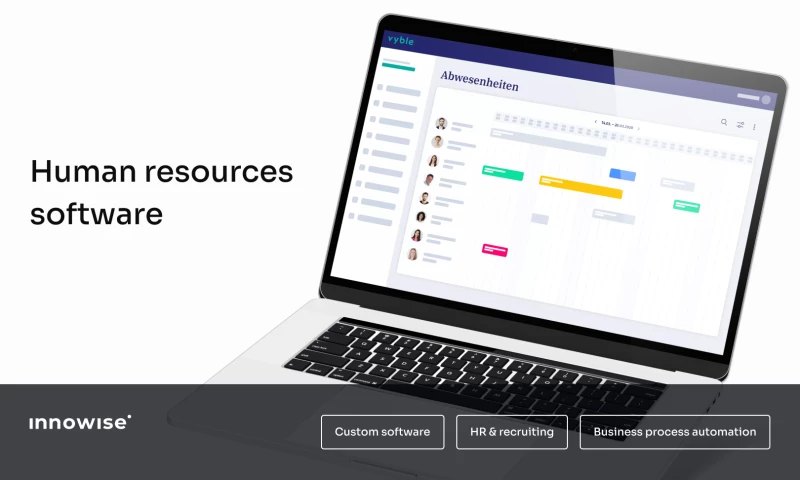
Software Development
Staff and payroll management system
- $500K - $1M
- 33 Months
- 2021
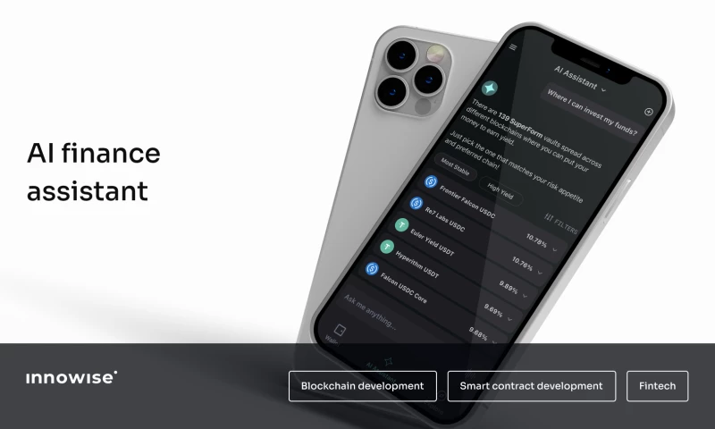
Software Development
A unified AI finance platform for fiat and crypto
- $500K - $1M
- 10 Months
- 2026
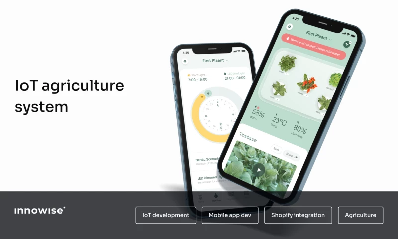
Mobile App Development
Smart home garden to grow plants with no soil
- $20K - $100K
- 16 Months
- 2023
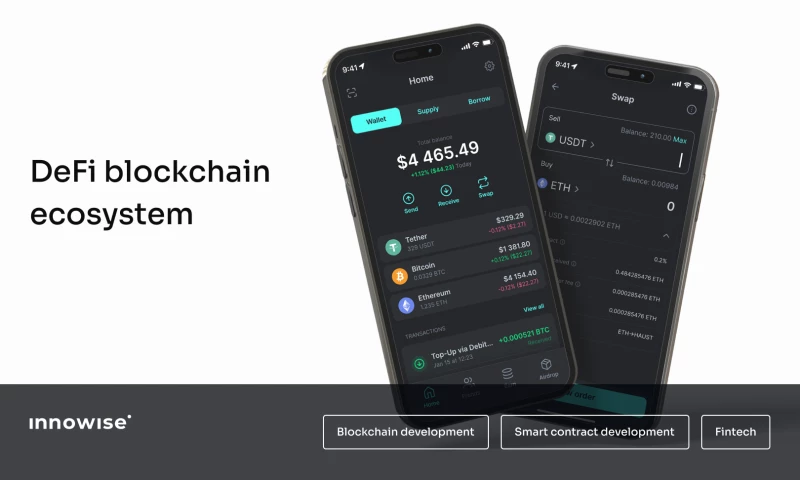
Blockchain
Blockchain ecosystem development
- $1M+
- 17 Months
- 2026
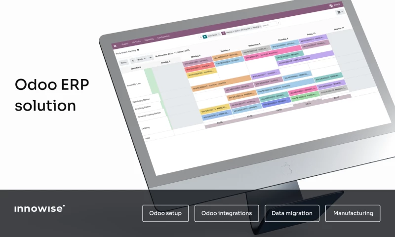
ERP Consulting
Odoo ERP for simplified project management
- $20K - $100K
- 4 Months
- 2024
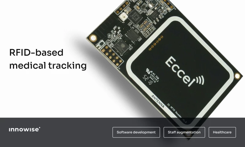
Software Development
Revamping RFID data decoding for medical devices
- $20K - $100K
- 1 Month
- 2024
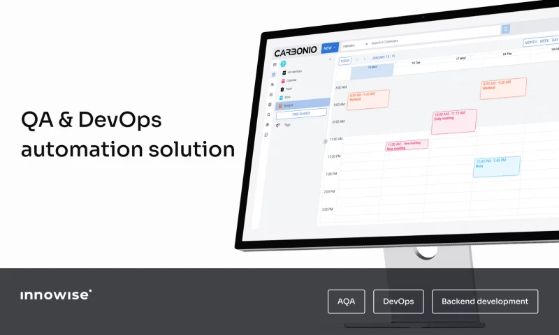
DevOps Consulting
Speeding up testing and deployment with automation
- $500K - $1M
- 40 Months
- 2026
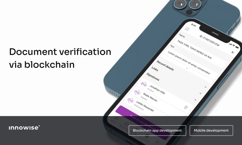
Blockchain
Mobile app for blockchain-powered document management
- $5K - $20K
- 14 Months
- 2021
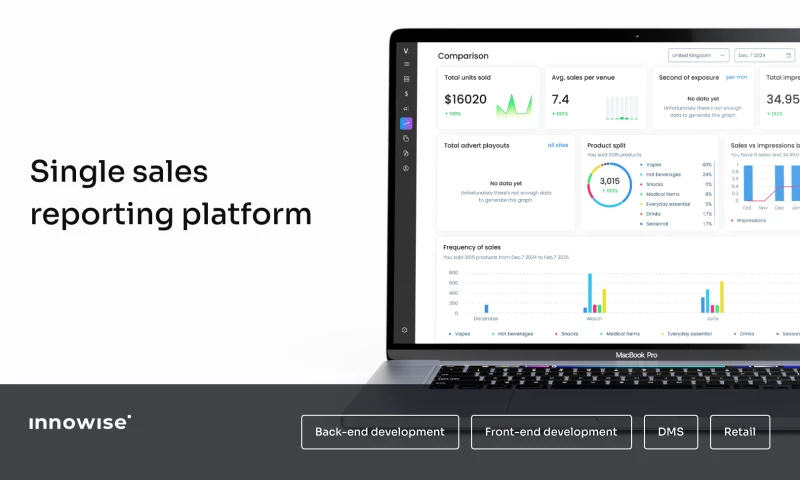
Software Development
Data aggregation and unification platform
- $20K - $100K
- 1 Month
- 2025
Innowise Group Reviews
Reviews from Google Maps and DesignRush are available on this profile.
All reviews
- All reviews
- Google reviews
- DesignRush reviews
We worked with another software developer on a custom database project. The project was going over budget and there were problems with the system. We brought on Innowise to take over, and we have been very pleased with our experience so far. The communication with the team has been excellent. They spend the time up front to really understand the problem being addressed. Their work is very efficient and cost effective. "David Allison's Review Sourced from Google
I’ve collaborated with Innowise on multiple client projects, and their team has consistently been timely, reliable, and easy to work with. What stood out most was their ability to leverage their large international network, which directly helped us secure clients here in the U.S. My main point of contact, Dmitri, quickly became like a second brain for me, anticipating needs, offering smart solutions, and making execution seamless. I’d recommend Innowise to any U.S.-based firm looking for dependable IT development and augmentation support. "Simon John Thomas's Review Sourced from Google
We’ve had an excellent experience working with Innowise. Their project management is top-notch. Everything was organized, clear, and efficiently executed, which made collaboration seamless. The team is incredibly responsive, always addressing questions and updates promptly, keeping the project moving without unnecessary delays. What stands out most is the real value they deliver: the quality of the development work far exceeds what we expected relative to the cost. Innowise combines technical expertise, effective communication, and a strong work ethic, making them a reliable partner for any development project. It’s rare to find a team that’s this professional, efficient, and genuinely easy to work with. I’d gladly recommend them to anyone looking for serious development support. "Neri's Review Sourced from Google
I've worked with the Innowise Team off and on for the past 4 years for software development projects and consulting services. Their team has always been extremely responsive to our questions and needs providing support. Their development teams are top notch and provided our company with great details and direction when it comes to the development of our applications to meet our customers needs! "Rob Beaven's Review Sourced from Google
At Arsh.Ai, we’ve found Innowise to be a highly reliable and professional software development partner.Their team has been responsive, knowledgeable, and consistently delivers high-quality work.Collaborating with them has been a genuine pleasure, and we truly value their commitment to excellence. "Abbas Mirza's Review Sourced from Google
Working with Innowise was a pleasure. They possess an excellent breath and depth of service and their technical staff are outstanding. Their business analysis and project management staff was very communicative and helped to keep our project moving along on time an on budget. I would highly recommend them for future projects. "Project Name: AmmoCrypt
- Project Type:
- Blockchain Development
- Company size:
- Under 49
- Industry:
- Financial Services
We worked with a Product Owner from Innowise to relaunch our website and redesign our mobile apps in just ten months. With his help, we were able to deliver in quality and on time. "Project Name: CodeCheck
- Project Type:
- App Development
- Company size:
- Under 49
- Industry:
- Information Technology and Services
Great outsourcing firm. Strong technical resources and flexible in finding candidates based on ever-changing market demands on our products. Highly recommend using them for any of your technical and non-technical needs. "Project Name: Definely Plugin
- Project Type:
- Software Development
- Company size:
- Under 49
- Industry:
- Computer Software
Innowise Group’s help allowed us to complete the project on time. Thier flexible approach resulted in a smooth partnership. They were responsive, and easy to work with, on top of being technically proficient. "Project Name: Video streaming platform
- Project Type:
- Software Development
- Company size:
- Under 49
- Industry:
- Information Technology and Services
Innowise Group is one of the best partners the client works with. They always fulfill our requests by providing developers that meet the client’s specific language and experience-level requirements. "Project Name: Development Resources for Staffing Company
- Project Type:
- Software Development
- Company size:
- Under 49
- Industry:
- Information Technology and Services
Innowise Group met and exceeded our expectations. With a deep understanding of business processes, they created a custom ready-to-use system with a robust set of features that we needed. "Project Name: Customer Software Dev for IT Development Company
- Project Type:
- Software Development
- Company size:
- Under 49
- Industry:
- Information Technology and Services
Innowise Group has a strong understanding of the task at hand, enabling them to offer the most suitable development approach. The team exceeded our expectations and is responsive when we request for changes. "Project Name: Mobile App Dev for Design Agency
- Project Type:
- App Development
- Company size:
- Under 49
- Industry:
- Marketing and Advertising
Innowise Group has built an amazing application from scratch in an amazingly short time of just about 3 weeks. Their seniority and in-depth experience in this field make them valuable partners. "Project Name: Mobile App Development for Blockchain Solutions Company
- Project Type:
- App Development
- Company size:
- Under 49
- Industry:
- Information Technology and Services
Innowise Group constantly found efficient solutions to the challenges. The resources were very helpful and communicative, and they demonstrated an impressive determination and eagerness to solve problems. "Project Name: Software Dev Staff Augmentation for Software Startup Company
- Project Type:
- Software Development
- Company size:
- Under 49
- Industry:
- Information Technology and Services
We ordered to create a Customer satisfaction tracking system based on Python to monitor our customers' feedback. Our main objective was to keep an eye on customer satisfaction to make instant improvements in software development processes. This helped to retain our clients, keep them happy, and save money without losing projects because of unsatisfied customers. "Project Name: Customer satisfaction tracking system
- Project Type:
- Software Development
- Company size:
- 500 - 999
- Industry:
- Computer Software
DesignRush
Agency Profile Review
Comprehensive analysis done by DesignRush Agency Experts.
What is Innowise Group Best For
- Comprehensive Mobile App Development, Software Development, AI solutions, Blockchain Development, and DevOps Consulting
- Strong expertise in Healthcare, Retail, SaaS, Transportation and Logistics, and Education industries, delivering best-in-class technology solutions
- Trusted by high-profile clients such as BMW, Deloitte, and Accenture, known for delivering quality and reliability
Strengths Assessment/Agency Pros
- Extensive services of digital solutions
- Outstanding technical staff
- Strong technical expertise
- Timely delivery within budget
- Ability to adapt to market demands
- Effective tools for customer satisfaction tracking
- Retention of clients and cost savings through continuous improvement
Portfolio
Expertise
IT outsourcing, mobile app development, blockchain, eCommerce development, machine learning, Android, Java, .NET, VR/AR, and AWS solutions.
Industries
Agriculture, technology, health care, eCommerce, and finance.
Breakdown
- 18% - Mobile app development
- 9% - eCommerce development
- 4% - Software development
- 9% - Android development
- 4% - .NET development
- 4% - Java development
- 4% - Machine learning
- 31% - IT outsourcing
- 4% - AWS solutions
- 4% - Blockchain
- 9% - VR/AR
Results
- Enhanced operational efficiency for clients through comprehensive ETL services, leading to an increase in data accuracy.
- Boosted funding for German farmers through a crowdfunding platform.
- Improved trading success for users of the ML-driven quantitative trading platform through advanced machine learning algorithms.
Clientele
Clientele Review
The agency serves a diverse array of clients, including top-tier enterprises and notable brands from the technology, automotive, consulting, and education sectors.
Notable Clients
- BMW
- Deloitte
- Accenture
- Topcon
- Tieto
Why Hire Them
- IAOP Global Outsourcing 100 Awards recipient, recognizing industry excellence.
- ISO 9001 certification for quality management systems, ensuring high standards in service delivery.
- ISO/IEC 27001 certification for information security management, demonstrating a commitment to data security.
- Experienced leadership with 19 years of management experience in software development, ensuring strategic direction and operational excellence.
- Skilled team with expertise in a wide range of technologies, including AI, blockchain, and cloud solutions, offering innovative development approaches.
- Strong background in business development with team members holding advanced degrees from prestigious institutions, facilitating effective client engagement and delivery of tailored solutions.
Innowise Group Team Bios

Pavel Orlov
Co-founder, CEO
With 19 years of experience in both software development and management, Pavel leads Innowise to reach new heights and become a leading software engineering and digital transformation company.

Dmitry Nazarevich
CTO
Dmitry leads the technological development at Innowise. He ensures that every project is a step towards the future, guiding the engineering team and implementing solutions that not only address challenges but also shape the future of the industry.
Vasili Kovalevich
Head of Business Development, Europe & USA
Vasili identifies strategic growth opportunities in Western markets, where each deal is built on trust and mutual benefit. He helps clients achieve their goals by providing innovative and effective solutions tailored to their businesses.

Veronika Olesik
CBDO, Co-founder
Veronika is a driving force behind the business. She leads strategic partnerships and company growth, ensuring that each solution is tailored to the client's needs. She builds long-term relationships, securing lasting success for all parties involved

Alesia Lihacheva
VP of Sales and Business development (Europe)
Alesia leads strategic development across Europe, delivering solutions that precisely meet client needs. Her approach is focused on constant innovation, helping companies optimize their processes and achieve the best results in the market.

Alex Chekel
Head of Business Development (UK & Ireland)
Alex focuses on strategic development for Innowise in the UK and Ireland, building partnerships that unlock new business horizons. He understands the importance of providing clients with solutions that help them grow and adapt.

Matvey Matveev
Chief Sales Officer (EAST)
Matvey transforms the challenges of the Eastern market into opportunities for growth. His ability to find personalized solutions helps clients reach new levels, optimizing processes and increasing their business efficiency.

Pavel Demeshkevich
Sales Director (Central Europe)
Pavel knows that in Central Europe, a personalized approach is key. He helps clients find solutions that exactly match their requirements, ensuring not just growth but maximum value from every project.

Egor Grischenko
VP of Sales and Business development (USA & Canada)
Egor is building the business in North America, delivering tech solutions that genuinely transform clients' businesses. His expertise helps companies find innovative ways to solve problems, accelerating growth and propelling them to the next level.
Vitaly Sandalidi
VP of Sales and Business development (DACH)
Vitaly helps clients in the DACH region build long-term strategic relationships by offering solutions that accelerate their growth. His deep understanding of market needs ensures that the technologies he offers provide a competitive advantage.
Innowise Group Clients
Innowise Group Awards